Contents
The Gallery
|
|
The Norfolk County Council E-map Explorer web site provides more images from ordnance survey maps, tithe/enclosure maps and aerial photographs taken in 1948 and 1988 (use post code NR18 9SZ). We cannot reproduce their images here because of copyright restrictions.
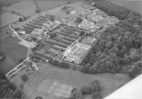
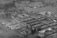
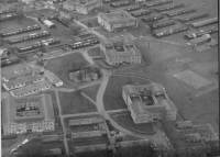
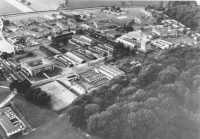
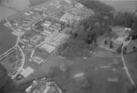
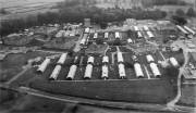
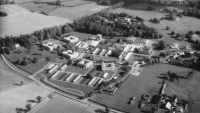
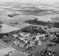
Early 1960s Two photos from the 1967 College Magazine Also .... check out the aerial photos in The Jim Douglas Collection Approx 1970 April 1972 Top 1978 Late 1980s (#1) Late 1980s (#2) 
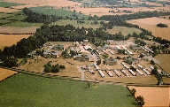
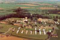
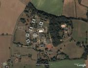
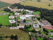
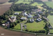
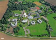
Top 1990s? Extended view of 1990s? College Site (2000) Top Morley St Peter (2000) Google Earth photo 2nd July 2007 (2 photos) Top Late summer 2007 2008
Wymondham College Remembered